The Carolinas braced for a storm that forecasters warned could bring heavy rain — as much as 6 to 8 inches in some spots. But one narrow band got a “firehose” that dumped as much as 20 inches in a so-called 1,000-year flood that shocked many with its intensity.
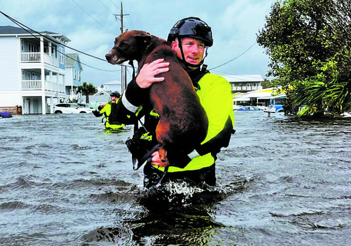
The storm that left homes flooded, cars submerged and schools closed Tuesday in parts of North Carolina wasn’t really a surprise to scientists who have long said that such rainfalls are one marker of climate change.
“Data shows one of the strongest relationships between climate change and precipitation is that as the atmosphere warms, the capacity to hold water increases. Therefore we see more intense rainfall in a shorter period of time,” said Andrew Kruczkiewicz, senior researcher at the Columbia Climate School at Columbia University.
Monday’s deluge centered on Carolina Beach south of Wilmington, where more than 18 inches of rain fell in 12 hours and almost 21 overall. That much rain qualifies as a 1,000-year flood expected only once in that length of time, meteorologists at the National Weather Service in Wilmington said.
Some areas were hit particularly hard as the storm took a narrow path over the region, “causing a bit of a firehose effect,” NWS meteorologist Lauren Warner said. The agency’s forecasts allowed for “locally higher” amounts, but those weren’t close to what eventually fell.
“If that had moved just a little to the left, that would have mitigated some of the totals that we saw or perhaps spread them out over a wider area,” said Warner. The worst flooding occurred over parts of just two counties, her colleague Tim Armstrong said.
Ocean Isle Beach, just a little over 30 miles from Carolina Beach picked up less than 4 inches of rain.
Carolina Beach Mayor Lynn Barbee said the 21 inches that fell on his town was impossible to fully prepare for even in a place accustomed to tropical downpours. “I don’t think I’ve ever seen it rain so hard and for so long,” said Barbee, who has lived on the coast for most of his life. “Not rain bands that get harder and let up or a front moving through. It just sat on top of us.”
The storm system was known as Potential Tropical Cyclone No. 8, but it never organized enough to become the eighth named tropical storm of the season.
The lack of a name added to the difficulty, Barbee said, since people pay more attention to named storms or hurricanes. Tourists were still arriving for beach vacations Monday at the height of the deluge. One family from Pennsylvania lost their van to the floodwaters and are in a shelter instead of their vacation rental, the mayor said.
“We’ve developed a communication dialogue. We communicate cones of uncertainty, expected path, time of arrival, strength on the Saffer-Simpson scale. People know what to expect. But suddenly we’re having storms that don’t fit on these scales,” Barbee said.